|
WASHINGTON FIRE RIPS OVER 1,000 ACRES,
EVACUATES SIX HOMESSEPTEMBER 09 -- METHOW, WA: A fast-moving fire in Okanogan County forced the evacuation of six homes, threatened ten more, and destroyed one building; the Squaw Creek Fire started about 4 p.m. yesterday southwest of Methow. The Seattle Times reported that it was estimated at more than 1,000 acres by early this morning.
Wonch's Type 3 team reported that the fire was at 600 acres late last night with zero containment. The fire spread rapidly to the northeast, running and spotting in the lighter fuels and torching in timber. The fire jumped a dozer line late in the evening.
About 7:30 p.m. four strike teams of state engines were ordered. Reed and Holloway's Type 2 team will take over the fire today.

PERRY'S SATURDAY RUN: ALMOST $33,000SEPTEMBER 07 -- LANCASTER, CA: On September 10 -- that's Saturday -- Kenneth Perry will set out from Fox Air Attack base at Lancaster for a 52-mile run to raise funds for the Wildland Firefighter Foundation.
 Pledges are being sought by the Foundation in support of Perry's "run for the money." Pledges are being sought by the Foundation in support of Perry's "run for the money."
An Air Tactical Supervisor for the BLM, Perry decided to make the run for the Foundation's 52 Club, the premise of which is to donate a buck a week to help injured firefighters or those killed in the line of duty and their families.
Perry's background includes smokejumping in Alaska and duty with the Fulton Hotshots on the Sequoia National Forest and the Kern County Fire Department. Five years ago he injured his back during a rescue operation in Alaska; even after a couple of surgeries he still deals with constant back and hip pain -- but he's found that long-distance running doesn't make his back any worse, and on Saturday he'll pull in over $600 for each mile he runs.
Perry and the Foundation are asking for pledges on a “per mile” basis in support of the 52-mile run, and today his fundraising potential for the 52 miles topped over $32,696. (!!!)
Notable pledges include Linda and Larry Shirley, who pledged $19.23 per mile "in loving memory of Retha," a pledge of $10 per mile from NorthTree Fire, another $10 per mile from Shawn Srader of the Hat Creek Ranger District on the Lassen, and numerous pledges from members of the SoCal IIMT #1 and SoCal IIMT #3 (award for IMT gang attack here -- you guys put the other teams to shame!!) and a real crew rally from the Chester Helishots. Smokejumpers are kicking in chunks of their paychecks, notably $5.77 per mile pledged from Wayne Risseeuw of the Redmond Smokejumpers, and a whopping $14 per mile from the McCall Smokejumpers (good on you jumpers there). The Arroyo Seco Crew #5 have been all over the donation page, the Redding jumpers got in for another five bucks per mile, and Ron Bollier with the Fulton Hotshots put in $10.10 per mile, just edging out the $10 per mile pledged by both Pete Coy of the Mill Creek Hotshots and Zach Snyder of the Del Rosa Hotshots. The Bear Divide Hotshots doubled those pledges with $20 per mile, and the great folks at the Supply Cache also chipped in for $20 per mile.
And then there's the pledge from "The Colonel" on the GreenhornFire, an impressive $23.50 per mile. C'mon, crews and teams, that's over $1,200 from one fine fire colonel. Surely you teams and crews can give the old man a run for his money on Kenneth's run for his money? (grin)
Better than that even, we've got John Armstrong of the Texas Canyon Hotshots who pledged TWENTY-FIVE DOLLARS PER MILE.
 Many pledges have been made in memory of fallen firefighters, and the aviation community makes a strong showing on the pledge list. Many pledges have been made in memory of fallen firefighters, and the aviation community makes a strong showing on the pledge list.
A referee will confirm the timing and distance of Perry's run, and pledges for funding to support the Foundation after the run will be sent directly to the Foundation. Spectators and cheerleaders and followers are encouraged. "If anyone happens to be in the area on that day," says Perry, "please feel free to stop by; spectators make great motivators!"
To make a pledge in support of Perry's run for the money, check the SUPPORT page on the Foundation website, and note on the form that you're pledging in support of Kenneth Perry's run. Check the pledge list and running totals at the pledge list page generously hosted by wildlandfire.com, or use their Pledge Entry Form for instant updates to the list. There are maps and other cool updated stuff about the run on that page, and further updates will be posted here and on the Foundation's news page at wffoundation.org/news and more information is available from the Foundation at (208)336-2996.
Perry's goal is to bring in $1,000 per mile, so get over there and sign up today!

FORT HALL FIRES OVER 17,000 ACRESSEPTEMBER 07 -- POCATELLO, IDAHO: Two wildfires on the Fort Hall Indian Reservation that were set off by dry lightning on Sunday have reached 17,481 acres and are at 38 percent containment. Suwyn's Type 2 team is managing the Fort Hall Complex, which includes the Rattlesnake Fire and the Sawmill Fire near Pocatello.
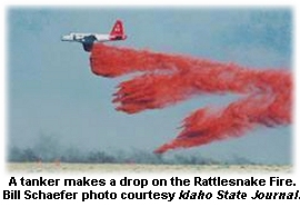 Joanna Wilson, fire information officer with the Eastern Idaho Interagency Fire Center, told the Idaho State Journal that the Rattlesnake Fire southwest of Pocatello was threatening several ranch buildings and had closed the Arbon Valley, Simplot, and Trail Creek roads. Joanna Wilson, fire information officer with the Eastern Idaho Interagency Fire Center, told the Idaho State Journal that the Rattlesnake Fire southwest of Pocatello was threatening several ranch buildings and had closed the Arbon Valley, Simplot, and Trail Creek roads.
The Sawmill Fire is northeast of Pocatello.
KPVI-TV reported that an ICP was set up near the Pocatello Airport.
The Pocatello municipal watershed is threatened, and crews reported that the fires are spreading primarily to the east. Portions of the fire are in steep and inaccessable terrain, and fire managers reported problems with unauthorized access into the fire area.
Suwyn's team has been coordinating firefighting goals with the Fort Hall Tribal Council. Almost 400 people are assigned to the fire, including 13 crews, four helicopters, 18 engines, and seven dozers.

NORTHWEST MONTANA FIRE 50 PERCENT CONTAINEDSEPTEMBER 04 -- PERMA, MT: Winds pushed the Seepay #2 Fire from about 3,000 acres earlier in the week to nearly 8,000 acres by last night. The fire's threatening about a half dozen homes and a powerline, and had earlier shut down Highway 200 because of smoke.
The Helena Independent Record reported that the fire's about 15 miles east of Plains, on the edge of the Flathead Indian Reservation.
Cowin's Type 2 team reported 50 percent containment last night on the 7,800-acre fire.
Steep rugged terrain with heavy fuel loadings could cause problems with containment today, and fire managers say they're counting on Type 1 crews and air support if the expected cold front arrives today. The fire's burning in heavy dead and down materials, with thick timber. About 675 people are on the fire.

GRANITE COMPLEX GETS TYPE 2 TEAMSEPTEMBER 04 -- RIGGINS, IDAHO: Lunde's Type 2 team took over the Granite Complex on the Idaho side of Hells Canyon this week, shifting from wildland fire use with limited suppression to a more ramped-up suppression strategy after the fire began threatening the management boundary.
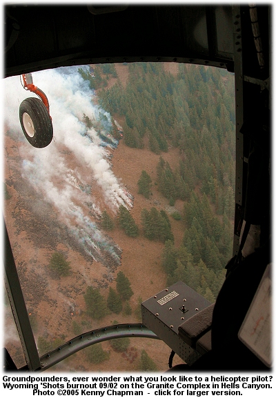 On Tuesday the fire was pushing 30,000 acres, and by last night it had reached almost 34,100 acres. On Tuesday the fire was pushing 30,000 acres, and by last night it had reached almost 34,100 acres.
The fire's been burning since August 7 about 30 miles east of Enterprise and 20 miles west of Riggins.
Last week the fire moved north across Sheep Creek and east into Lightning Creek and North Fork Lightning Creek, threatening to breach the wildland fire use management boundary on the northeast perimeter; fire managers decided to actively suppress the fire in that area.
Heavy helicopters have been dropping water and retardant on the fire, with hotshots on the ground securing fireline and burning out.
"Once a fire crosses that maximum boundary, you have 48 hours to get it back within the line," Information Officer Brian Miller told the La Grande Observer. "If you can't do that, you have to declare a wildfire."
The fire's about seven miles north of Hells Canyon Dam, and threatening four structures. Lunde's team plans to continue burnouts using aerial ignition reinforced by crews on the ground. They're also doing some structure protection assessment.
About 445 people are now on the fire, including ten hotshot crews, nine engines, and six helicopters.

SIGNAL ROCK FIRE AT 10,000 ACRESSEPTEMBER 04 -- PHILIPSBURG, MT: High winds earlier in the week kept helicopters on the ground and crews off the lines and forced officials to close the road over Skalkaho Pass -- which allowed the Signal Rock Fire to almost triple in size in one day.
Information Officer Ted Pettis told the Ravalli Republic that safety concerns outranked suppression efforts for a day. "There was so much smoke and fire, we couldn't get near it," he said. "You can't put people in front of 100-foot flames and expect them to be able to do anything."
Some crews were also pulled off the Signal Rock Fire to work on the Copper Creek Fire, burning at the creek's head in the Anaconda-Pintler Wilderness. That 70-acre fire could threaten properties near Moose Lake if heavy winds blew in.
The Signal Rock Fire was 5 percent contained last night at 10,000 acres. About 17 miles southwest of Philipsburg, it's burning in lodgepole and subalpine fir, and yesterday's crown runs and spotting caused the fire to grow by about 1,300 acres in just 24 hours. About 245 people are on the fire, which is being managed by Turman's Type 2 team.

TWO NEW IDAHO FIRESSEPTEMBER 04 -- MACKAY, IDAHO: A new fire in south-central Idaho yesterday was burning in the wilderness near Stanley and another was threatening up to 50 structures near the old mining town of Idaho City. An AP report in the Salt Lake Tribune said airtankers were diverted from the Idaho City fire to help on the one near Stanley.
The Gregory Fire southwest of Idaho City was at 150 acres with zero containment. Fire managers said red flag conditions today could cause the fire to threaten as many as 50 homes to the east of the fire, along with Idaho City and nearby powerlines. The fire is burning in heavy logging slash and tall dry grass; shifting winds yesterday were pushing the fire toward Idaho City.
About 170 people are on the fire, including firefighters from the Boise and Gem County rural fire departments and the Eagle City Fire Department.
The Wildhorse Fire had spread to about 160 acres by Saturday evening; zero containment was reported. Fire managers evacuated numerous campers from the Wildhorse Campground.
The Sunset Mountain Lookout spotted smoke from the fire about 1 p.m.
About 150 firefighters are on the fire, along with C-130 tankers out of Boise. Winds of up to 15 mph are forecast for today, with temperatures in the low 80s and RH of 10 percent.

FIRE NEAR GORMAN THREATENS 1,000 HOMESSEPTEMBER 03 -- GORMAN, CA: A fire that started today near Gorman had burned about 2,500 acres by 6 p.m. and was just 10 percent contained. About 1,000 homes are threatened, according to Dyer's L.A. County team, and evacuations were under way tonight with Frazier Park threatened.
One home and about three outbuildings were confirmed destroyed; NBC4-TV reported that two vehicles and a travel trailer were destroyed. L.A. County Fire Department Inspector Ron Haralson said Los Angeles and Kern county fire crews were on the fire, along with Los Angeles city firefighters and crews from the U.S. Forest Service and six fixed-wing USFS aircraft.
About 400 personnel are assigned. Firefighters reported that the fire was spotting and making runs at structures in light fuels, with pockets of heavy fuel.

PERRY APPROACHES $27,000SEPTEMBER 03 -- LANCASTER, CA: On September 10 -- that's next Saturday -- Kenneth Perry will set out from Fox Air Attack base at Lancaster for a 52-mile run to raise funds for the Wildland Firefighter Foundation.
 Pledges are being sought by the Foundation in support of Perry's "run for the money." Pledges are being sought by the Foundation in support of Perry's "run for the money."
An Air Tactical Supervisor for the BLM, Perry decided to make the run for the Foundation's 52 Club, the premise of which is to donate a buck a week to help injured firefighters or those killed in the line of duty and their families.
Perry's background includes smokejumping in Alaska and duty with the Fulton Hotshots on the Sequoia National Forest and the Kern County Fire Department. Five years ago he injured his back during a rescue operation in Alaska; even after a couple of surgeries he still deals with constant back and hip pain -- but he's found that long-distance running doesn't make his back any worse.
Perry and the Foundation are asking for pledges on a “per mile” basis in support of the 52-mile run, and today his fundraising potential for the 52 miles topped over $26,612. (!!!)
Notable pledges include Linda and Larry Shirley, who pledged $19.23 per mile "in loving memory of Retha," a pledge of $10 per mile from NorthTree Fire, another $10 per mile from Shawn Srader of the Hat Creek Ranger District on the Lassen, and numerous pledges from members of the SoCal IIMT #1 and SoCal IIMT #3 (award for IMT gang attack here -- you guys put the other teams to shame!!) and a real crew rally from the Chester Helishots. Smokejumpers are kicking in chunks of their paychecks, notably $5.77 per mile pledged from Wayne Risseeuw of the Redmond Smokejumpers, and a whopping $14 per mile from the McCall Smokejumpers (good on you jumpers there). The Arroyo Seco Crew #5 were all over the donation page in the last day or two, and the Redding jumpers were in this morning for another five bucks per mile, and Ron Bollier with the Fulton Hotshots put in $10.10 per mile! The Bear Divide Hotshots almost doubled that today with $20 per mile.
And then there's today's pledge from "The Colonel" on the GreenhornFire, an impressive $23.50 per mile. C'mon, crews and teams, that's over $1,200 from one fine fire colonel. Surely you teams and crews can give the old man a run for his money on Kenneth's run for his money? (grin)
Better than that even, we've got John Armstrong of the Texas Canyon IHC who pledged TWENTY-FIVE DOLLARS PER MILE today.
 Many pledges have been made in memory of fallen firefighters, and the aviation community makes a strong showing on the pledge list. Many pledges have been made in memory of fallen firefighters, and the aviation community makes a strong showing on the pledge list.
A referee will confirm the timing and distance of Perry's run, and pledges for funding to support the Foundation after the run will be sent directly to the Foundation. Spectators and cheerleaders and followers are encouraged. "If anyone happens to be in the area on that day," says Perry, "please feel free to stop by; spectators make great motivators!"
To make a pledge in support of Perry's run for the money, check the SUPPORT page on the Foundation website, and note on the form that you're pledging in support of Kenneth Perry's run. Check the pledge list and running totals at the pledge list page generously hosted by wildlandfire.com, or use their Pledge Entry Form for instant updates to the list. There are maps and other cool updated stuff about the run on that page, and further updates will be posted here and on the Foundation's news page at wffoundation.org/news and more information is available from the Foundation at (208)336-2996.
As of today Perry is earning about $512 per mile for the Foundation. His goal is to bring in $1,000 per mile, so get over there and sign up today!

NIFC SENDS CREWS SOUTHSEPTEMBER 01 -- BOISE, IDAHO: The National Interagency Fire Center has dispatched over 1,000 firefighters to the relief effort in the wake of Hurricane Katrina's devastation of the Gulf Coast. KTVB-TV reported that crews are being sent to base camps set up near the hurricane-wasted areas.
"Right now, we are trying to give as many resources as possible to the hurricane relief, while still maintaining the necessary firefighting capabilities in the West," said Phil Street with the U.S. Fish and Wildlife Service at NIFC. Four Type 1 teams have been deployed, and two more are expected to be sent in the next few days. Ten hand crews are working to clear debris, and NIFC expects to provide more crews, radios, and supplies. KIDK-TV reported that outside of the military, NIFC has the largest warehouse in the world of low-power and handheld radios, including satellite communications equipment. Steve Jenkins, chief of NIFC's Incident Communications Division, said they could immediately supply over 2,000 radios if needed.

FIRE THREATENS GRAND JUNCTION WATER SUPPLYSEPTEMBER 01 -- PALISADE, CO: A 426-acre fire at the base of Grand Mesa is threatening nine homes and the watershed that supplies Palisade and Grand Junction.
The Summit Daily News reported that crews were working to keep the Blowout Fire out of the watershed. The fire started late Tuesday on private land and spread to BLM land yesterday; Fowler's Type 3 team yesterday reported 10 percent containment, and a CBS-4 report said the fire had grown to 700 acres this morning.
The fire's burning in piñon-juniper, sage, and grass over steep and rocky terrain. Access is limited by poor roads, and some areas of the fire are inaccessible. The fire was actively crowning at 3 a.m. yesterday, with extreme fire behavior, torching, and active burning in flashy fuels.
The Rocky Mountain News reported that two SEATs and a heavy airtanker were dropping retardant to keep the fire from moving uphill on the mesa. More than 140 firefighters, two helicopters, a dozen engines, and a dozer are assigned.

BLAISDELL: FROM CAMPFIRE TO 5,000 ACRESAUGUST 29 -- PALM SPRINGS, CA: An escaped campfire northwest of Palm Springs tore across dry grass, pushed by hot dry winds through the San Jacinto Mountains, and temporarily evacuated the threatened community of Palm Oasis near the site where the fire started.
Garwood's Type 2 team reported this morning that the fire was 20 percent contained at 4,980 acres.
Residents were allowed to return to Palm Oasis yesterday after a voluntary evacuation. About 730 firefighters are assigned, along with seven airtankers, ten helicopters, 67 engines, and 12 water tenders. The fire's in steep and inaccessible areas of the upper reaches of Chino Canyon. Helicopter water drops are planned for today, and crews plan to use established helispots to cold-trail the accessible parts of the fire perimeter.
The Blaisdell Fire started when a campfire got out of control; three people were cited and could face fines for suppression costs.
The Palm Springs Desert Sun reported that fire forced officials to shut down the Palm Springs Aerial Tramway, but the cable cars and stations weren't damaged by the fire.

GRANITE COMPLEX NEARS 20,000 ACRESAUGUST 28 -- RIGGINS, IDAHO: The Granite Complex grew about 700 acres yesterday on the Idaho side of the Snake River in Hells Canyon; the complex is being managed as a Wildfire Use incident, but spot fires, increased fire behavior, and threats to Sheep Creek Cabin have prompted fire managers to actively fight portions of the fire.
The complex is about seven miles north of Hells Canyon Dam, in a very remote and inaccessible area. Late Friday afternoon and evening, the fire behavior picked up, and Cones's WFU team ordered four hotshot crews and a second heavy helicopter.
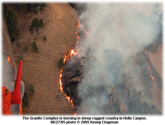
Multiple bucket drops near Sheep Creek on Friday stopped a spot fire, and half of a fire use module was combined with a squad of Malheur Rappellers to reinforce the bucket drops. The other half of the module worked on structure protection at Low Saddle Microwave Tower and the Cold
Springs Cow Camp.
Firefighters expect the fire to continue spreading to the northeast until significant rainfall occurs, and they expect continued active fire behavior in the areas below 4,000 feet elevation. Priorities include protecting the Sheep Creek Ranch Cabin and associated structures, and keeping the fire from crossing Sheep Creek toward the northern boundary of the Maximum Manageable Area (MMA), a fixed perimeter of the fire set by fire managers for "wildfire use." If the fire spreads beyond that MMA boundary, it's actively suppressed as a wildland fire.
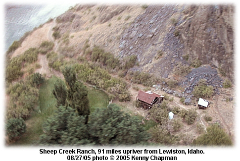
The Sheep Creek Ranch buildings are 1/8 mile east of the Snake River on Sheep Creek. The ranch is 91 miles upriver from Lewiston, Idaho; it's the last homestead reached by the jet boat mail run up the river. The ranch was established in 1913 by William McLeod, and the Forest Service acquired the property in the early 1970s. Snake River Adventures has been leasing it since 1985.
Forty-two people are assigned to the 18,687-acre fire; firefighters are expecting red flag conditions today.

CENTRAL OREGON FIRE EVACUATES 150 HOMESAUGUST 26 -- LaPine, OR: A fire this afternoon that quickly grew to over 100 acres evacuated the LaPine State Recreation Area and about 150 threatened homes to the south, according to KGW-TV. The Park Fire put up a plume that drifted north toward Bend and rained down ash on the park.
Oftentimes emergency shelters for residents evacuated from fire areas aren't close to filled, but the Red Cross reported that by 8 p.m. tonight about 90 people had checked in at LaPine Middle School.
Four airtankers made trips from the Redmond Air Center to drop on the fire till they ran out of daylight.

DEER CREEK FIRE THREATENS OVER 100 HOMESAUGUST 27 -- CAVE JUNCTION, OR: The 1,635-acre Deer Creek Fire just east of Selma was 40 percent contained this afternoon but still threatening more than 100 homes and about 125 other structures. Five homes were confirmed destroyed and another two were damaged, according to the Type 1 team managing the fire.
Hot, dry, and windy weather has contributed to the fire's spread and the difficulty in containing the fire, which is burning in heavy fuels in steep and rugged terrain. A dry cold front is expected tomorrow afternoon that could produce strong and shifting winds and threaten the firelines.
The evacuation of residential areas around the fire that was ordered yesterday was lifted at noon today, but a significant threat to structures still exists because of heavy fuels in the area and predicted weather. Crews this afternoon reported that all control lines were tied in and mop-up was under way on parts of the perimeter.
About 1,500 people are working on the fire, including the Illinois Valley Fire Department, Forest Service, CDF, Josephine County crews, and county sheriff's department personnel.

SW OREGON FIRE BURNS HOMES, EVACUATES 40 FAMILIESAUGUST 26 -- CAVE JUNCTION, OR: A wildfire east of Selma burned several homes yesterday and forced the evacuation of about 40 families; the Deer Creek Fire was spreading quickly in dry grass.
"It started as a three-acre grass fire," said Brian Ballou with the Oregon Department of Forestry, "and grew by leaps and bounds by the hour. It hasn’t been moved along by strong winds, but it just keeps finding fuel."
Last night three homes were confirmed lost along with 12 outbuildings; eight other structures were reported damaged. Fire managers reported this afternoon over 100 homes threatened.
The Josephine County sheriff’s department called for a voluntary evacuation after the fire destroyed homes, according to the Mail-Tribune. It's burning eight miles north of Cave Junction; a hot dry air mass that set up west of the Cascades yesterday afternoon, along with a high Haines Index, caused the fire to put up a huge convection column at about 8 p.m. The column was visible for miles and showed up on satellite imagery.
KVAL-TV reported today that the fire was "moving fast and furious" and that "the inferno blackened 1,800 acres of dense forest and at least four homes." KVAL-TV also noted that "800 more firefighters, including about one-hundred from the local group Skookum, were called out Friday to join the 200 already fighting the blaze."

AGGRESSIVE ATTACK STOPS SW OREGON FIREAUGUST 24 -- MEDFORD, OR: A fast-moving fire off Highway 140 near Lake Creek yesterday flared up an embankment along the highway, pushed by steady east winds on a dry day. The Jack Spring Fire grew to about 35 acres near the site of July’s 1,520-acre Wasson Fire; Brian Ballou with the Oregon Department of Forestry said it was burning in an area with a heavy fuels load of old logging slash.
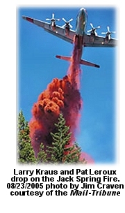 Two ODF crews hiked up the ridge to work the fire, and the highway was shut down briefly as an airtanker hit the fire with retardant. Three helicopters also dropped water on the fire, which was west of Lake of the Woods. Two ODF crews hiked up the ridge to work the fire, and the highway was shut down briefly as an airtanker hit the fire with retardant. Three helicopters also dropped water on the fire, which was west of Lake of the Woods.
"We’ve managed to get water around the whole fire," Ballou told the Mail-Tribune late in the day. "They’re going to continue hitting it with a lot of water."
He said ODF boosts resources sent to a known trouble area like the Highway 140 corridor this time of year; they dispatched 13 engines and two dozers, and Jackson County crews also responded.
Problematic weather is forecast for southwestern Oregon over the next two or three days. A frontal passage with gusty and strong steady winds yesterday moved across eastern Oregon and the Columbia Basin and caused flare-ups from lightning holdovers. Five of the 65+ starts reported since Sunday are currently staffed.
Two new large fires were reported yesterday in Oregon; the Fly Fire southwest of La Grande reported zero containment this morning at 500 acres. Burning in grass, timber, and slash, the fire spread rapidly yesterday with strong west/northwest winds for most of the afternoon. Short crown runs were a problem until airtankers and heavy helicopters working in unison were able to slow the spread toward nightfall. Goheen's Type 2 team has been ordered.
East of Frenchglen near Steens Mountain, the Fir Creek Fire is at 800 acres with zero containment. The fire made major runs yesterday, and airtankers worked till they ran out of daylight. Two major campgrounds and a number of primitive camping areas were evacuated.
Also, the Lakeview dispatch center reported that they're closely watching a 4,000-acre fire in northwestern Nevada called the Barrel Fire, which is bumping the border southeast of Adel, Oregon.

PILOT WALKS AWAY FROM SEAT CRASHAUGUST 24 -- ELKO, NV: A single-engine airtanker crashed yesterday afternoon while working the 6,800-acre Sherman Fire 15 miles north of Elko -- but the pilot walked away from the wreckage with minor injuries.
The SEAT was owned by Airwork Enterprises of Florida, with offices in both Texas and Florida, and was under contract with the BLM. The company owns three 660-gallon Turbine M18-A tankers, along with an 800-gallon AirTractor 802.
The Reno Gazette-Journal reported that the Sherman Fire is the largest of five started Monday by lightning in the area; it was 35 percent contained last night.
The Elko Daily Free Press called it a "ring of fire" around Elko. Bill Roach, dispatch center manager in Elko, said the local volunteer departments were scrambling. "For example, the Spring Creek Volunteer Fire Department put out ten fires in one day," he said. "They were discovering new fires on their way to others and dealt with them immediately. When the lightning storm moved through the area, we had fire reports from every direction."
Firefighting was difficult in the steep, rugged terrain, and there's limited access to the fire, which made a strong run toward the community of Ryndon and prompted an order for Muir's Type 2 team. They will take over the fire this evening.
The fire's burning in dormant brush and hardwood slash, grass, sage, bitterbrush, and juniper. About 260 people are on the fire.

22 OREGON CREWS SUSPENDEDAUGUST 22 -- BEND, OR: The Oregon Department of Forestry last week suspended 22 private firefighting crews across the state when it was determined that required permits for those crews had not been obtained by the firefighting contract companies that employ the crews.
"Somebody pulled strings in the middle of the fire season," said Rick Herson, owner of Oregon Woods Inc. of Eugene. "The loser in this deal is the taxpayers."
Oregon Woods is not listed as a member of the National Wildfire Suppession Association, a nonprofit association of firefighting companies.
The Bend Bulletin reported that some of the suspensions were based on information from a state lawmaker and Deschutes County Forester Joe Stutler, who said the crews were based in Deschutes, Josephine, and Jackson counties.
Complaints from Rep. Chuck Burley of Bend, along with Stutler, notified ODF officials that the crews had broken the terms of a state contract that's used to dispatch private crews in the Pacific Northwest. ODF staff oversee contract crews for the states of Washington and Oregon and the five federal agencies with firefighting responsibility. The rules require firefighting contract companies to obtain local government permits that allow them to dispatch firefighters. That rule's purpose is to certify the actual location in the state where the business is located, and was formulated in response to the previous practice -- by some contractors -- of setting up a temporary "business address" at a campground or other local site in order to receive dispatches in that part of the state. The crews that were suspended didn't have the required permits.
The new contract rules were partly a response to a series of fatal accidents involving firefighters driving long distances to and from fires, according to Grayback Forestry's Mike Wheelock.
In August last year, ODF terminated its agreement with contractors Mountain Forestry and Westwood Resources, Inc., over contract violations after investigations by the agency's Contract Services Unit. Independence-based Mountain Forestry was dropped from the 2004 Interagency Fire Crew Agreement when inspection of their training records uncovered falsified and undocumented records. Westwood Resources, a contractor with crews offered in Klamath Falls, was terminated for not having authorized dispatch locations.
The contract agreement prohibits dispatch locations from being changed once the bid solicitation for services has closed. Verified dispatch locations ensure that firefighters meet performance and work/rest standards, including traveling safely under conditions of the agreement.

CDF TESTS GELAUGUST 20 -- UKIAH, CA: It's new and it's blue and CDF's decided to use it statewide in the S2-T tankers. It's called Thermo-Gel, developed by Thermo Technologies, and has already been used on fires all over northern California.
The Ukiah Daily Journal reported that the gel concentrate, when mixed with water, adheres to any kind of surface, even vertical window panes. CDF did a test drive on the gel at Hemet-Ryan last fall. They dropped 22,880 gallons in 20 different drops over a testing period from August 14 till the first of October.
CDF has used the gel exclusively this fire season because of environmental concerns with retardant. The gel comes in different colors, but the base at Ukiah is using blue.
"The color is distinguishable on trees, grass, brush, and timber," said George Hall, former Ukiah Fire captain and division chief with All Terrain Fire Emergency Services, the company supplying the gel to the base.

PULASKI TRAIL DEDICATION TOMORROWAUGUST 19 -- WALLACE, IDAHO: On the afternoon of August 20, 1910, when the wind hit dozens of burning backcountry fires, the result was an inferno of almost unimaginable intensity. The fires merged till the flame front was 50 miles from side to side. Three million acres burned in two days, from north-central Idaho to northwest Montana. Five towns were destroyed, and at least 78 firefighters and seven civilians were killed.
Featured today in the Missoulian is the story of the U.S. Forest Service ranger named Ed Pulaski, who led 45 firefighters into a mine shaft, then stood guard at the entrance to turn back those who tried to flee in panic.
Tomorrow, 95 years after Ed Pulaski led his men to safety, the Forest Service will help dedicate a new trail to the old mine site. The trail was once well-worn by people and horses from Wallace to the St. Joe country, but over the decades the trail was forgotten and became overgrown. Jim See, who's been hiking the area's hills since the mid-1980s, said the trail was more or less abandoned, not even a true trail. But the more he learned about Pulaski's story and the fires of 1910, the more he became convinced that the trail was historically significant.
He and others launched the Pulaski Project, a private-public effort to negotiate easements across private lands along the trail, and secure a congressional appropriation of $300,000 and private funding of $147,000 for the trail.
See said there's not much evidence left of the 1910 fires along the trail, but interpretive signs along a two-mile route will tell the story.
Tomorrow's dedication ceremony will be held at the trailhead on Moon Pass Road just outside Wallace -- one of the Idaho towns devastated by the 1910 inferno. The trail itself is not yet open to the public, but should be fully open by October. The dedication's scheduled for 1 p.m. at the Pulaski Tunnel Trail trailhead. Note that there is NO PARKING available at the trailhead; school buses will pick up passengers at Wallace High School and the Northern Pacific Depot starting at 11:45 a.m. The same buses will return visitors after the ceremony.
For more information on the dedication and the project, check out the Pulaski Project website.

BLOSSOM 30 PERCENT CONTAINED TONIGHTAUGUST 18 -- MARIAL, OR: The spread of the Blossom Complex slowed some yesterday, and parts of the Rogue River were reopened to boaters and rafters. AP reports said the Rogue was reopened to commercial boaters in the nine miles from Grave Creek to Black Bar, but remained closed between there to Marial.
The fire was at 8,644 acres yesterday, up 255 acres from Tuesday, and it was at 9,124 acres tonight with 30 percent containment.
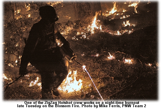
Crews finished building eight more miles of fireline and are continuing burnout operations. Last night only a few hot spots remained along the riverbank between Marial and Blossom Bar, and crews were working on firelines on the Big Meadow flank.
Resources this morning included 65 crews, 45 engines, 38 water tenders, and 10 helicopters.
Lohrey's Type 1 team reported tonight that 15 homes, four commercial properties, and almost 60 outbuildings have been threatened, including homes east of Mule Creek and at Paradise Lodge and Half Moon Lodge. Complex burning operations have been slowing containment efforts, but experts have been brought in; low fuel moistures and the potential for spotting have required carefully coordinated progression of the burnouts.

PERRY APPROACHES $9,000AUGUST 17 -- LANCASTER, CA: On September 10 Kenneth Perry will set out from Fox Air Attack base at Lancaster for a 52-mile run to raise funds for the Wildland Firefighter Foundation.
 Pledges are being sought by the Foundation in support of Perry's "run for the money." Pledges are being sought by the Foundation in support of Perry's "run for the money."
An Air Tactical Supervisor for the BLM, Perry decided to make the run for the Foundation's 52 Club, the premise of which is to donate a buck a week to help injured firefighters or those killed in the line of duty and their families.
Perry's background includes smokejumping in Alaska and duty with the Fulton Hotshots on the Sequoia National Forest and the Kern County Fire Department. Five years ago he injured his back during a rescue operation in Alaska; even after a couple of surgeries he still deals with constant back and hip pain -- but he's found that long-distance running doesn't make his back any worse.
Perry and the Foundation are asking for pledges on a “per mile” basis in support of the 52-mile run, and today his fundraising potential for the 52 miles topped over $8,800.
A referee will confirm the timing and distance of the run, and pledges will be sent directly to the Foundation.
Spectators and cheerleaders and followers are encouraged. "If anyone happens to be in the area on that day," says Perry, "please feel free to stop by; spectators make great motivators!"
To make a pledge in support of Perry's run for the money, check the SUPPORT page on the Foundation website, and note on the form that you're pledging in support of Kenneth Perry's run. Check the pledge list and running totals at the pledge list page generously hosted by wildlandfire.com, or use their Pledge Entry Form for instant updates to the list. Further updates and the run route will be posted here and on the Foundation's news page at wffoundation.org/news and more information is available from the Foundation at (208)336-2996.
As of today Perry is earning about $170 per mile for the Foundation. His goal is to bring in $1,000 per mile, so get over there and sign up today.

STATE OF EMERGENCY IN IDAHO COUNTYAUGUST 17 --GRANGEVILLE, IDAHO: Ten large wildfires were burning yesterday in Idaho; eight of the country's 13 most serious fires are in Idaho, and three are within striking distance of Grangeville, in Idaho County above the confluence of the Snake and Salmon rivers.
The Meadow II and Upper Meadow fires on the Nez Perce National Forest southeast of Elk City have reached approximately 600 acres and are being assessed today by Bennett's Type I team. A new fire camp will be established near Elk City. The Upper Meadow Fire is at 600 acres; it's been unstaffed since Monday when 17 smokejumpers were pulled off the incident because of safety concerns. Bennett's team assumed command late yesterday; they'll also take on the Herman Fire in the Gospel-Hump Wilderness and the China Ten Fire on the Clearwater Ranger District.
The Idaho Mountain Express reported that one fire rapidly burned more than 24,000 acres near Craters of the Moon National Monument last week; it was contained Friday. Two smaller fires ignited in the Sawtooth Wilderness last week, and the King of the West Fire was burning Tuesday near Dollarhide Summit west of Ketchum. The fire had three crews on it, along with six SEATs and three helicopters. It was named after an old mine in the area.
Farther north, Idaho County is under a state of emergency with four large fires, three of which are within 25 miles of Grangeville. Gov. Dirk Kempthorne declared a state of emergency on Friday.
The China Ten Fire, burning in heavy fuels on the Nez Perce National Forest, has been handled by Thomas's Type 2 team, who reported that area travel restrictions for public safety were initiated yesterday; the fire is 40 percent contained at 1,860 acres with 430 people assigned.
Continuous falling snags have been a problem, and the fire is adjacent to a significant Indian cultural area; it's burning in heavy dead and downed material, mostly beetle-killed lodgepole and subalpine fir.
Also on the Nez Perce, the Blackerby Fire southeast of Grangeville is at 4,800 acres and 60 percent containment. Resources include 15 crews, 39 engines, seven dozers, six helicopters, and 15 water tenders. The West Fork Fire east of Riggins is 40 percent contained at 400 acres; full containment's predicted for Friday.
Heavy spring rains in the region produced grasses and other light fuels that are as much as three times denser and taller than normal. Sheri Ascherfeld at NIFC said officials are preparing for the worst.
"Overall there is a lot of concern for the state of Idaho," she said. "If we don't get any moisture, the fire season could stretch into the fall." She said long-term projections include above-average temperatures and below-normal precipitation for Idaho through August.

STORMS MAKE A MESS OF SOUTHERN CALIFORNIAAUGUST 15 -- SAN BERNARDINO, CA: Lightning storms sloshed rain and hail across the high desert from Sunday afternoon to Monday morning, causing power outages, flooding, and flood-related collisions from Lucerne Valley to Barstow. John Salvate, a battalion chief with the San Bernardino County Fire Department, told the San Bernardino Sun it was one of the worst storms he could remember. He said county firefighters responded to 62 calls between 8 p.m. Sunday and 8 a.m. Monday.
On Monday afternoon the National Weather Service reported a severe thunderstorm moving through Barstow, with winds of 10 to 15 mph and hail the size of marbles.
Diane Cadenhead, a dispatcher at the CHP's Barstow office, said visibility was down to 50 feet and and the area had a lot of flooding.
On Sunday about 16,000 residents were without power. Southern California Edison said power was restored to about 5,000 of those by Monday morning.
Storms in Lucerne Valley caused a fatal traffic collision Sunday and prompted a swift-water rescue early Monday morning. County firefighters and CHP officers responded when a tractor-trailer and another vehicle became stuck in the mud in Lucerne Valley.
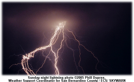
Besides starting fires, lightning kills and injures people more often than people think; a number of firefighters have been injured or killed by lightning. In late July, Boy Scouts from St. Helena, California, were huddled under a tarp in Sequoia National Park during a hail storm when a bolt of lightning hit their shelter. The L.A. Times reported that a Scout and a leader were killed, and six others were injured. Five days later, Scouts from Salt Lake City were in a three-sided log shelter in a thunderstorm in Utah's Uinta Mountains when lightning struck a nearby tree; it killed an Eagle Scout and injured three others.
Lightning experts say the two tragedies illustrate a basic truth: There is no safe place to be outdoors in a lightning storm.
Lightning kills an average of 75 people each year in the U.S. and injures another 500 or more -- making it more deadly than hurricanes or tornadoes and far more common than people imagine.
Ron Holle, a government meteorologist for 33 years who now works for Vaisala and is considered a leading expert on lightning safety, said both Boy Scout groups were near trees that might have attracted the lightning strikes.
The National Outdoor Leadership School's Backcountry Lightning Safety Guidelines suggest that people in a storm assume the lightning position. "This position includes squatting (or sitting) and balling up so you are as low as possible without getting prone. … If you are concerned enough to assume the lightning position, you should have your group dispersed at least 50 feet apart to reduce the chances of multiple injuries."
Holle said lightning follows all paths down and then spreads out across the ground. About half of all lightning deaths and injuries occur when voltage comes up through a victim's feet. If you're lying down with the full length of your body touching the ground, it's even worse, he said, and if you're close to a tree, "we're talking about serious voltage."
For more information and resources on lightning safety, see the struckbylightning.org website.

SCOOPERS ROCK IN THE BOUNDARY WATERS;
SPIKED CREWS EVADE KILLER SNAGAUGUST 14 --ELY, MN: When the Alpine Lake Fire in the blowdown area of the Boundary Waters Canoe Area Wilderness caught a west wind and headed for the Gunflint Trail last week, officials had to consider evacuating the 70 or so homes, cabins, and resorts at the end of the trail, but they still had the scoopers.
And the ground crews. A bunch of them who were spiked out in the Boundary Waters ducked away from a big snag that came after them Saturday night. It came crashing down at a spike camp just as a boatful of firefighters were unloading. "The firefighters had to dive," reported Stegmier's Type 2 team. They said no one was injured, but the boat was damaged.
Minnesota's CL-215 tankers, though, according to the Star-Tribune, have made the difference on the fire between disaster and successful suppression.
"These planes have proved to be one of the greatest investments the state could make," said Steve Jakala, assistant fire manager on the Superior National Forest. Jakala said the two CL-215s owned by the Minnesota Department of Natural Resources and a third on loan from North Carolina were credited with holding the fire, scooping water from Seagull Lake for drops on the parts of the fire that were pretty much inaccessible by ground crews, even by boat and canoe.
Tanker 266's chief pilot Don MacDonald laughed about the old oft-swallowed myth about scooping scuba divers. He and co-pilot Cameron Douglas said the CL-215 can't collect divers or even fish, and is definitely not designed for comfort.
MacDonald, who worked as a bush pilot in British Columbia, has been driving the CL-215s for nine years, the last five contracted with the DNR in Minnesota. He's worked hundreds of fires across the state and dozens in other states that sometimes borrow or rent Minnesota's scoopers.
Olin Phillips, DNR's head of fire management, said the income from other states and what they've saved Minnesota have made the scoopers (at $3 million apiece) pay for themselves and then some. "They're practically worth their weight in gold," he said.
Stegmier's Type 2 team reported tonight that the Alpine Lake Fire was 35 percent contained at 1,335 acres. A rash of local concerns from residents (mostly confusion about locations of burnouts) has prompted daily public meetings with the team. Threats to homes have been reduced by holding lines the last couple days, and difficult crew access by boat was overcome somewhat today by adding more spike camps (with 70 firefighters spiked out last night), and the approval of two wilderness helispots.
The blowdown areas and thick conifer pole timber remain concerns, though, and numerous snags in the rocky soils have become more of a risk to firefighters.
The fire's still threatening over 70 homes within a couple miles; about 250 people are assigned to the incident. Priorities for the next couple days include suppression in critical areas before the fire reaches the shoreline of Seagull and Alpine Lakes.

BLOSSOM GAINS 1,700 ACRES AND A T1 TEAMAUGUST 12 -- BLOSSOM BAR, OR: The BLM closed the wild section of the Rogue River to rafting yesterday after the Blossom Fire jumped containment lines and burned to within a mile of the river at Marial, one of the most popular spots on the portion of the river that's restricted to permit holders.
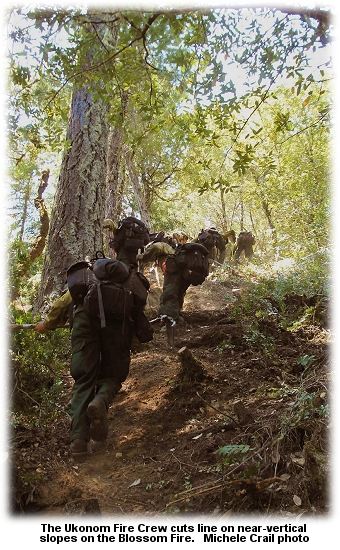 According to AP reports, boaters and rafters were barred from starting new trips at Grave Creek, but jetboats can still run upriver fromn Agness to Blossom Bar. According to AP reports, boaters and rafters were barred from starting new trips at Grave Creek, but jetboats can still run upriver fromn Agness to Blossom Bar.
The Blossom fire was ignited July 21 by lightning about a mile north of Paradise Lodge. It's burning in steep and rugged canyonlands in the Wild Rogue Wilderness. The fire was 40 percent contained this morning at 4,980 acres.
This morning the Curry County Sheriff’s Department issued an evacuation order for the Rogue River Ranch and Marial Lodge. Structural protection has been put in place.
When the smoke inversion over the fire lifted yesterday, the fire became very active, with spot fires from the day before growing quickly. By mid-morning it was clear that containment lines had been compromised. The fire on the north slopes of Mule Mountain put burning embers aloft, and they were carried south with a lot of ash.
Fire managers expect the fire to reach the river in a few days and are planning to burn out around some structures and some other sections from the Rogue River Trail.
Unified command is in place with the Oregon Department of Forestry, the agency responsible for suppression on lands east of the fire. Along with 13 crews, resources include five heavy helicopters, one medium, and two light helicopters -- for a total of 625 personnel.
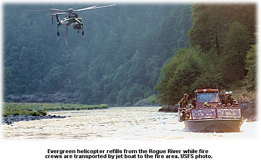
Some crews are reaching their two-week limits and timing out, and replacement crews are on order.
Paul's Type 2 team reported yesterday that the Type 1 helicopters on the fire have been critical to successful burnout operations.
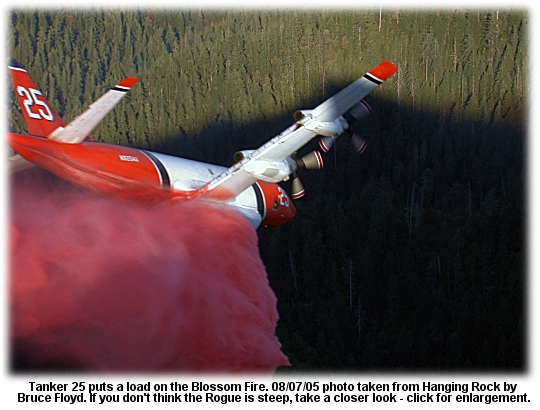
Numerous lodges, resorts, recreational facilities, and homes along the river are threatened; crews have been challenged by the inaccessible steep terrain, sheer cliffs, and rolling materials.
The fire's burning in an area that includes spotted owl habitat and marbled murrelet habitat, along with numerous cultural sites and historic mines.
Burnouts along
the west and north flanks were completed yesterday; the burnouts resulted in an acreage increase but most of the containment lines have been holding. When fireline on the east was compromised yesterday, crews began to focus on the eastern contingency lines.
A team briefing was held in Gold Beach and Lohrey's Type 1 team is taking over the fire.

IDAHO FIRE EVACUATES GRANGEVILLE RESIDENTSAUGUST 12 -- GRANGEVILLE, IDAHO: A voluntary evacuation of about 70 homes threatened by the 2,000-acre Blackerby Fire was put into effect yesterday after the fire quadrupled in size. Five percent contained last night at 2,000 acres, the fire is threatening homes on its north, west, and south flanks. T&E species and powerlines to Elk City are also threatened.
One firefighter was injured yesterday when his dozer tipped over; he was treated at a local hospital but was not seriously injured.
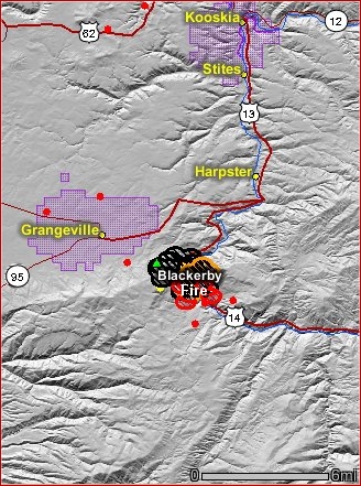 The Idaho Statesman reported that resources have been stretched thin; airtankers ran out of retardant Wednesday night. Brian Shiplett, fire manager for the Idaho Department of Lands in Coeur d'Alene, told the Seattle Post-Intelligencer that more resources are on order. The Idaho Statesman reported that resources have been stretched thin; airtankers ran out of retardant Wednesday night. Brian Shiplett, fire manager for the Idaho Department of Lands in Coeur d'Alene, told the Seattle Post-Intelligencer that more resources are on order.
"They've ordered more resources onto it after they pumped the Grangeville Air Center completely out of fire retardant," he said.
Residents were urged to comply with the voluntary evacuation. Idaho County Sheriff Larry Dasenbrock said a wind shift could cause the fire to threaten a lot more homes.
"We've been making emergency notifications," he said, "finding out what kind of resources people have, giving them information on emergency shelters that are available, and advising them to move hazardous fuels away from their homes."
"The idea is not to have any flames licking at your bumper as you leave," said Pat McKelvey with the Nez Perce National Forest.
Heintz's Type 2 team is handling the fire, with 245 people assigned; it burned actively from Wednesday evening till about 3 a.m. and then burned through the day on all but the western flank.
The fire crossed the South Fork of the Clearwater River and took out a powerline early Thursday morning, leaving residents in the nearby communities of Elk City and Dixie without power. Crews were expecting extreme fire activity with uphill runs along the river breaks.

RATTLESNAKE FIRE MEMORIAL VANDALIZEDAUGUST 11 -- WILLOWS, CA: Just two months after the memorial dedication for the Rattlesnake Fire in Grindstone Canyon, the memorial site's been vandalized.
"We're all heartsick about it," said Phebe Brown with the Mendocino National Forest. "It was all volunteer money and volunteer time that put it together."
She told the Chico Enterprise-Record that someone shot through the display board and damaged the mission bell that originally belonged to the New Tribes Mission in Fouts Springs. Fourteen of the firefighters killed on the Rattlesnake Fire lived at the missionary camp.
The memorial overlook took three years to design and install. The Forest Service urges anyone who may have information about the vandalism to call the Mendocino's supervisory law enforcement officer Daryl Rush at (530)934-1164.

MONTANA DEPLOYMENT: NO INJURIESAUGUST 11 -- NINEMILE, MT: Crews were pulled off the line on the Tarkio Fire along I-90 west of Missoula yesterday afternoon, and three firefighters deployed shelters when the fire blew up last night.
The Missoulian reported that all three firefighters were unharmed and have contacted their families to let them know about the incident.
A routine investigation of the circumstances of the deployment is under way.
The I-90 Complex is being managed by Sandman's Type 1 team; it's currently 45 percent contained at 5,500 acres and is burning on the north side of the freeway near the town of Alberton. The fire's destroyed only two outbuildings, but is threatening 125 homes, 15 commercial properties, and another 150 structures.
Priorities on the fire include structure protection in towns and communities and the BPA powerline; steep rugged terrain, dry fuels, afternoon winds and associated fire behavior have made the fire risky for crews, along with hazards associated with the adjacent freeway and railroad. The West Mountain Community remains evacuated, and yesterday the Tarkio Fire was moving toward BPA's high-value utility corridor.
Scouting for a contingency line adjacent to the West Mountain community has been completed, and it's flagged in case the fire spots across the eastern flank.
Information Officer Tom Rhode told the Missoulian that the fire became active after 4 p.m., made significant runs, and jumped the lines on both the north and east sides. The contingency plan for protection of the BPA powerlines was activated as winds pushed the fire toward them; crews working the northern and eastern perimeters of the fire were pulled back from the lines as the fire headed north and northeast. A large smoke column above the fire could be seen for miles. Power in the lines from eastern Montana was diverted to other lines as the fire approached; helicopters and an airtanker made repeated retardant drops between the fire front and the powerlines to slow it down. When smoke triggered the shutdown, though, residents didn't lose power -- because BPA officials had already identified alternative lines to which power could be diverted.
The I-90 fires were ignited August 4 either by a vehicle on the interstate or by an arsonist. As many as 22 fires were originally burning; two remain, the most significant of which is the Tarkio Fire. Over 900 people are assigned to the fire. All eastbound and westbound lanes of the freeway were re-opened to traffic yesterday.

LATE WINDS KICK FIRE INTO NIGHTTIME RUNAUGUST 11 -- RICHLAND, WA: A 4,000-acre fire on the Wahluke Slope of the Hanford Reach National Monument took off last night after winds picked up and blew it into a run.
The McClane Fire was estimated at 60 percent or more contained late in the afternoon, and was relatively calm, but a sudden and strong wind shift about 6 p.m. kicked the fire into a significant run to the north and east. Fire managers then decided to order up Jennings's Type 2 team, and they say the fire could go to 8,000 acres before it's contained -- particularly if the erratic gusty winds continue.
Extreme fire behavior was a problem last night between 9 and 11 p.m. The fire changed direction suddenly and damaged the fire camp, which had to be moved. The fire has burned severely in very old sagebrush, and micro-climate weather effects are proving troublesome.
The fire's about ten miles north of the Ringold Hatchery and five miles south of Highway 24; it's threatening three homes and has destroyed a couple of outbuildings. It's also threatening ag lands and fish and wildlife habitat and has caused powerline issues with BPA. Re-routing power in the area may be necessary because of similar issues with BPA lines in Montana.
Crews today are working on establishing an anchor on the northern perimeter and containing the most troublesome part of the fire. They expect it will continue moving to the north and east toward State Route 24 and Mountain Vista Road.
Mike Ritter, U.S. Fish and Wildlife Service deputy project leader at Hanford Reach, told the Tri-City Herald that the fire started Tuesday afternoon when a farmer lost control of his field burn. He said the fire could burn up into mature shrub-steppe habitat on the Wahluke Slope -- the most pristine stretch of the Columbia River.
"It's roaring right now," said Ritter yesterday. "The wind is picking up. We are extremely concerned; it could jump a line at any time." He said the fire's burning mostly in an area of wet and mushy terrain, too dangerous in spots to get firefighters in. Ritter said retardant can't be used because water in the area eventually returns to the Columbia River, but a SEAT out of Richland was able to drop retardant some distance from the water, and an Air-Crane dropped water on the fire during the afternoon.
The Hanford Reach National Monument is located within the driest and hottest portion of the Columbia Basin. A wide variety of habitats across the Monument supports a diverse array of wildlife species; the shrub-steppe ecosystem includes an unusually large number of native plant and animal species.
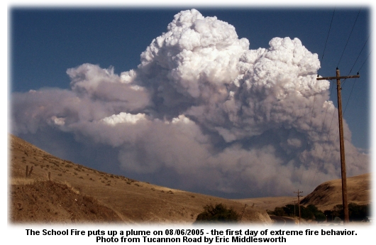
Southeast of the McClane Fire, the School Fire is still holding at 42,000 acres and is 40 percent contained. There's a good slide show of photos of the School Fire on the Tri-City Herald site.

SCHOOL FIRE SLOWS AT 42,000 ACRESAUGUST 10 -- POMEROY, WA: Anderson's Type 1 team is managing the School Fire in southeast Washington, with more than 1,400 firefighters assigned. Resources include six hotshot crews, 32 Type 2 crews, 139 engines, eight helicopters, 42 water tenders, and 14 dozers; managers estimate the crews have about 20 miles of line yet to put in before containment's assured.
At least 49 homes have been confirmed destroyed with another 120 are threatened; teams are assessing damage and the number of homes destroyed will likely be increased. The fire was at 40 percent containment tonight.
Other threatened resources tonight include Rose Springs, Stentz Springs, and Camp Wooten Recreation Areas, the Clearwater Lookout, and the Big Springs Recreation Area. Fire managers expect that private dwellings in Asotin County could also be threatened within the next couple days.
Projected size of the fire by the time it's contained is estimated at 50,000 acres.
The Olympian reported today that the fire was moving more slowly, with low humidity and temperatures in the mid-90s. The south end of the fire continues to burn into steeper, rougher country on the Umatilla National Forest.
Anderson's team has more information online.

MICHIGAN FIRE EVACUATES 100AUGUST 10 -- HOUGHTON, MI: More than 100 people were ordered out of their homes in the path of a lightning-caused fire that started Monday afternoon near a commercial blueberry farm. The Rice Lake 2 Fire was 85 percent contained yesterday at 389 acres; it's burning in the Rice Lake area of the Keweenaw Peninsula northeast of Houghton.
Local law enforcement officers told the Detroit Free Press that winds of 25 mph pushed the fire to 700 acres, but Ahnen's Type 3 team said that accurate mapping resulted in the revised size of the fire.
Difficult access and swampy terrain made containment efforts difficult; the fire's burning through mostly spruce and alder, and RH has been near 90 percent. Five firefighters were treated for smoke inhalation and heat exhaustion. Fourteen fire departments with a combined 250 firefighters were on the fire Monday night, and airtankers from Ontario were on standby.

EASTERN OREGON FIRE BURNS NEAR MT. HARRISAUGUST 09 -- LA GRANDE, OR: A wildfire that started Sunday afternoon northeast of La Grande was probably caused by lightning; the fire last night was 40 percent contained at 450 acres after burning through grass, brush, and agricultural fields -- and about 100 acres of timber near Mt. Harris.
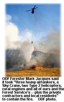 The Rinehart Road Fire threatened ranches and homes. The Imbler Rural Fire Protection District called for assistance from the Oregon Department of Forestry, and crews from Elgin, Cove, La Grande, and Union also responded. Aerial resources included three airtankers and three helicopters, and the La Grande Observer reported that tankers put 14 loads of retardant on the fire. The Rinehart Road Fire threatened ranches and homes. The Imbler Rural Fire Protection District called for assistance from the Oregon Department of Forestry, and crews from Elgin, Cove, La Grande, and Union also responded. Aerial resources included three airtankers and three helicopters, and the La Grande Observer reported that tankers put 14 loads of retardant on the fire.
Hessel's Type 3 team has set up a fire camp at Imbler High School, and about 135 people are assigned. About a half dozen homes remain threatened.
Southeast of La Grande, the Mule Peak Fire on the Wallowa-Whitman is 70 percent contained at 1,150 acres. As a safety precaution because of predicted lighning in the area and lightning strikes occurring in Baker, crews were pulled out of the wilderness area coyote camp on Sunday afternoon. Three Type 1 crews were demobed yesterday, two were reassigned, and one had timed out.

WINDS PUSH ALPINE LAKE FIRE INTO THE BLOWDOWNAUGUST 09 -- GRAND MARAIS, MN: The Alpine Lake Fire burned actively yesterday afternoon, reaching 690 acres by last night with zero containment. Winds of 20 mph in the afternoon drove upslope runs into the 1976 Roy Lake burn, and firefighters reported that fire behavior in the blowdown area was much more intense than on the other areas of the fire. Crews were pulled off the lines yesterday afternoon.
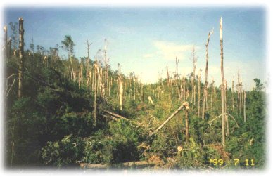 The fire's about 50 miles north of Grand Marais on the north side of Seagull Lake. The fire's about 50 miles north of Grand Marais on the north side of Seagull Lake.
The blowdown of nearly a half million acres in the Boundary Waters Canoe Area Wilderness was the aftermath of the July 4th storm in 1999 -- the worst natural disaster to strike the Boundary Waters since it was designated in 1964. The damage was caused by the biggest thundercell on record for the area and was likened to the aftermath of the 1980 Mt. St. Helens eruption.
Estimates on July 13 -- after aerial survey -- indicated that 386,000 land acres (total of 478,000 acres counting water) of the 1.1-million-acre wilderness area were affected. Nearly 800 campsites, 80 miles of portages, and over 130 miles of hiking trails were damaged.
The year before, more than 200,000 people from throughout the world visited the Boundary Waters. The Forest Service and other agencies had no way of knowing at the time how many campers were in the Boundary Waters, nor where they might be; there are nearly 2,200 campsites in the area. Miraculously, very few injuries occurred. But officials couldn't be sure that people weren't still trapped, so they ran the request for help to Boise.
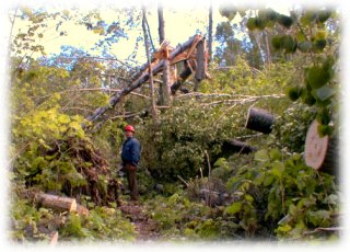 Sacramento Hotshot Ridge Watson clears his way
across one of the tangled portages in 1999. |
The Sacramento Hotshots, based on the Lincoln National Forest in New Mexico, arrived July 9 at the incident command post in Ely. They were requested through the National Interagency Coordination Center in Boise for assistance with search and rescue efforts.
"In some places, the downed trees are stacked up for acres," said Ralph Bonde, the incident commander for the 1999 operation.
Besides the huge fuel-choked blowdown area, the Alpine Lake Fire's burning in mature fir, pine, spruce, aspen, and birch.
The Duluth News-Tribune reported 93º heat yesterday, and airtankers worked the fire near Alpine Lake, about five miles southwest of the end of the Gunflint Trail. The fire jumped a creek that was considered a fire break, and burned closer to developed areas, backing into the wind and burning into the blowdown.
The fire started in dry jack pine on the northern edge of the 1999 blowdown.
Ground crews on Monday laid about 4,000 feet of hose on the portage between Seagull and Grandpa Lakes. Pumps at either end will supply a sprinkler system like that typically deployed by Canadian crews, creating a wet line to keep the fire from cabins and outfitters at the end of the Gunflint Trail.
Three CL-215 scoopers, two Beaver airtankers, and a helicopter worked the fire; on Sunday they dropped 270,000 gallons on the fire. Cook County Sheriff Mark Falk credited the pilots with keeping the fire away from people and property; Tanker 12 was on the fire today, too.
Jim Sanders, forest supervisor on the Superior, said a campfire ban may be in order; much of the region has gone more than five weeks with below-average rainfall. He flew over the fire late Sunday and he was surprised how dry the forest was. Forecasts call for a 30 percent chance of showers through Wednesday night.
Fire management plans include protection of more thaan 70 facilities near Seagull, Gull, and the Saganaga Corridor. The fire's under Unified Command with the Minnesota Incident Command System and the Cook County Sheriff. Crews today are building line to secure the southwest side of the fire along Alpine Lake; they're also working on fire breaks for a possible burnout tomorrow.
About 16 campsites on five lakes have been closed.

SCHOOL FIRE TAKES OFFAUGUST 08 -- POMEROY, WA: Shifting winds and dry fuels accounted for a fire that grew from 150 acres Saturday morning to 32,000 acres by Sunday night. The School Fire has destroyed 35 homes, and another 120 are threatened; about 175 homes and three campgrounds were evacuated.
The Seattle Times reported that farmers were plowing firebreaks through fields of wheat and other crops, trying to save this year's harvest. The fire yesterday was about 10 miles south of Pomeroy.
Heavy smoke grounded aircraft for much of yesterday, and firefighters said the fire was putting up a large plume and creating its own weather. It's burning in timber, brush, grass and croplands, and much of it is on the Umatilla National Forest. The fire burned into the Tucannon River Canyon and jumped the river, burning north and east on steep ground with flashy light fuels under timber.
Holloway's Type 2 team has been managing the fire, and they reported zero containment last night. Hazards to fire crews include spotting, steep slopes, rolling debris, snags, and heavy recreational use. Structure protection has been challenging because there are three separate fire protection jurisdictions in the area.
Anderson's Type 1 team arrived last night and has taken over the fire. About 600 people are assigned.

DIRTY FACE FIRE 30 PERCENT CONTAINEDAUGUST 04 -- ISSAQUAH, WA: Despite temperatures in the 90s and heavy dry fuels, crews have reached the 30 percent mark on the Dirty Face Fire in Chelan County.
Residents of 75 homes near Lake Wenatchee were allowed to return yesterday after the fire forced evacuations on Monday. The 965-acre fire, on the south slope of Dirtyface Mountain northwest of Leavenworth, came within 100 yards of some houses.
About 75 homes are under a Level 2 evacuation order, meaning residents must be ready to leave at a moment's notice. Fire managers said there are numerous homes in multiple subdivisions threatened, along with campgrounds, a state park, and commercial properties in the high-use recreational area around Lake Wenatchee. More than 600 firefighters are assigned.
Crews and air resources are working on containment lines today, and structure protection around homes is still a priority. Firefighters are focusing on the area west of the Lake Wenatchee Forest Service office near the avalanche run-out zone, because of rolling debris. If hot rolling debris continues to threaten escape in this area, crews are prepared to conduct burnout operations around the structures.
KOMO-TV reported that
Gov. Christine Gregoire flew over the fire by helicopter on Tuesday and said August could be a tough month for the state of Washington. "The best thing that's happened here, frankly, is the local folks got on it immediately," she said.

LITTLE IDAHO FIRE SMOKES UP MISSOULAAUGUST 04 -- SALMON, IDAHO: Smoke in the western sky over Missoula last night was not from a Montana fire, according to the Missoulian, but it appeared that a fire on Black Mountain, Blue Mountain, or Lolo Peak was smoking up Missoula. The 3-acre fire yesterday afternoon was about 10 miles west of Lolo Pass; Missoula smokejumpers and two helicopters were on it.
The Silver Creek Fire, ignited by lightning on Tuesday, is southwest of Salmon, Idaho, and Svalberg's Type 2 team took it over last night, with about 200 people assigned. It was holding at about 50 acres, and by 8 p.m. it was 50 percent contained. Fire managers said continued aerial support was holding the fireline with bucket and retardant drops.
Two heavy airtankers were dropping on the fire out of Missoula today.
Across western Montana, new starts showed up yesterday afternoon as the day heated up. On the Lolo and Bitterroot national forests, most of the fires resulted from lightning strikes earlier in the week. Although there were about 18 new fires on the Lolo, most in Mineral County, all were relatively small.

RETARDANT SAVES LOOKOUTAUGUST 04 -- UNION, OR: Rough inaccessible terrain, volatile fuels, and dry hot weather have made the Mule Peak Fire in eastern Oregon a fire to be reckoned with. But protective wrap and a retardant drop have saved the lookout on top of Mule Peak.
Management team members told residents at a community meeting in Union Tuesday night that it might be a while before the fire is contained. It's now at 10 percent containment, and the immediate goal is to keep it out of the Minam and Elk Creek drainages.
"It's a very difficult fire to get your arms around," said Carl West, IC on the Northwest Oregon Incident Management Team. The 1,090-acre fire's burning mostly within the Eagle Cap Wilderness. The ICP is at the Union athletic complex, with spike camps at Taylor Green and at Buck Creek. More than 700 firefighters are assigned.
The La Grande Observer reported that lightning ignited 19 fires on the Wallowa-Whitman last Thursday, and most were caught in initial attack. "Initial attack crews responded and did a very commendable job Thursday," said Forest Supervisor Steve Ellis, "but you never get them all, and this is one they didn't get." He said rappellers went in early on the fire, but were forced to pull back.
There's a lot of subalpine fir in the area, and it burns hot. "That's a pitchy, mossy tree," said District Ranger Kurt Wiedenmann, "and once fire gets into it, it flames like a Roman candle."
"Subalpine fir is nasty stuff," said John Denne with the Wallowa-Whitman National Forest. "We might be working on this fire for a while because of the fuel types."
The fire on Friday threatened the Mule Peak Lookout. The two employees who were stationed there were evacuated by helicopter from the lookout, a wooden building on the 8,679-foot summit of Mule Peak. Crews wrapped fire-resistant material around the building as a precaution, and an airtanker dropped retardant, saving the tower and other buildings.
The Baker City Herald reported that smoke from the fire has been visible from the Baker Valley and the Grande Ronde Valley.

50-YEAR CELEBRATION NEXT WEEK IN WILLOWSAUGUST 04 -- WILLOWS, CA: On August 13 at the Willows Airport, the Mendocino National Forest will host an anniversary day marking the 50th year of aerial firefighting.
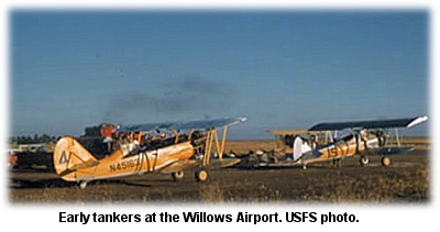 The anniversary day will honor the original flyboys of aerial firefighting in a tribute to 50 years of fighting fire from the air. In 1955, local pilots Floyd and Vance Nolta, of the Willows Flying Service, successfully modified a Stearman biplane to drop water on fires. Airtanker number 1 was in business. The anniversary day will honor the original flyboys of aerial firefighting in a tribute to 50 years of fighting fire from the air. In 1955, local pilots Floyd and Vance Nolta, of the Willows Flying Service, successfully modified a Stearman biplane to drop water on fires. Airtanker number 1 was in business.
The first drop on a fire was during the Mendenhall Fire, August 13, 1955, on the Mendocino. Vance Nolta flew the Stearman and dropped six loads of water on the fire. It was considered so successful that he worked another fire the very next day.
In 1982, the 25th anniversary of the first water drop on the Mendenhall Fire, the USFS honored the original fire pilots with a ceremony and a plaque at the Willows Airport.
The anniversary at Willows on Saturday, August 13, will feature displays of vintage aircraft, airtanker demo drops, and historical exhibits. The Forest Supervisor's Office in Willows will also have Mendocino National Forest historical photos and memorabilia on display from noon to 4:00 p.m. The program at the airport will include a fly-by of a Stearman and an N3N cropduster, and a demo by the Redding Smokejumpers is also planned. Static displays of USFS and CDF airtankers and other aircraft are also scheduled.
Available online are several commemorative t·shirts featuring anniversary art that includes a Stearman biplane water drop and a retardant drop by Tanker 66.
Professional fire photographer Kari Greer donated the photos for the shirts. All profits from the shirts will benefit the AAP memorial fund.
The keynote speaker at the anniversary will be Frank Prentice of Chico, one of the original seven pilots in the first airtanker squadron that operated out of the Willows Airport.
Other sponsors include CDF, Glenn County, Frank and Lila Prentice, the City of Willows, and the Willows Chamber. For more info email Phebe Brown at [email protected] or call (530)934-1137.

WEED'S MEMORIAL AIR MUSEUMAUGUST 03 -- WEED, CA: The guest of honor at the dedication for the new Siskiyou Firefighter Memorial Air Museum came in early Friday, courtesy of a strong tailwind. This was the last flight for CDF's retiring S-2A airtanker number 94 -- the first of three aircraft planned for the air museum, which will memorialize northern California firefighters who lost their lives in the line of duty.
 "It's only appropriate that the dangers these people fight on the ground and in the air be recognized," said Siskiyou County Supervisor Bill Hoy. He said the arrival of T-94 was "a great moment," according to the Mt. Shasta News, and he thanked veteran CDF pilots Cotton Mason and Bob Valette for flying the airtanker into retirement at her new home in Weed. "It's only appropriate that the dangers these people fight on the ground and in the air be recognized," said Siskiyou County Supervisor Bill Hoy. He said the arrival of T-94 was "a great moment," according to the Mt. Shasta News, and he thanked veteran CDF pilots Cotton Mason and Bob Valette for flying the airtanker into retirement at her new home in Weed.
"I'm sure we all feel a bit melancholy to see this last landing," he said.
Tanker 94 in 1956 was a carrier-based anti-submarine warfare plane; retired in 1980, T-94 was
converted five years later for CDF firefighting, and logged nearly 3,800 hours of service as an airtanker.
"It's been a good plane for us," said Mason. "Now we're proud to have it here in Weed."
Friday's dedication was held one day after the anniversary of the deaths of three firefighters from the Lassen National Forest; Steve Oustad, Heather DePaolo, and John Self -- crew of Lassen's Engine 11 -- died on July 28, 2002 on the Stanza Fire near Happy Camp.
Tanker 94 will be joined in the future by an OV-10 Bronco and a HUEY helicopter at the memorial museum.
Aviation maintenance technician Cameron Poer took the S-2A down the runway to her tie-down spot. Before he shut the engines down, he ran them at 1200 rpm for a minute; he paused as they roared for the last time. "Listen to that sound," he said. "I kind of hate to turn them off."

HAWAIIAN FIRE EVACUATES 5,000AUGUST 03 -- WAIKOLOA, HAWAII: A fast-moving brushfire on the Big Island of Hawaii has forced the evacuation of nearly 5,000 people, and the town of Waikoloa has been cut off. CBS News reported that the 25,000-acre fire has closed the only road connecting Waikoloa to the rest of the Big Island.
Evacuation orders moved 75 percent of the town's 6,500 residents from their homes. The fire's burning along the Kohala Coast on the west side of the island.
The Honolulu Advertiser reported that county fire officials last night completed a house-to-house check and reported no homes were burned, but officials told residents to expect smoke damage. The fire's no longer an immediate threat to Waikoloa Village, but roadblocks on Waikoloa Road stopped traffic on the mauka (inland) side of the village, with local traffic only allowed on the makai (seaward) side of the road.
Dry weather and winds of 10 to 20 mph with gusts of up to 30 mph made firefighting difficult. Persistent dry conditions led Mayor Harry Kim in May to declare a state of emergency for the entire Big Island after the National Weather Service reported rainfall in some areas was half of normal levels or less.
The fire burned in areas used for live-fire training during World War II, and Fire Battalion Chief Curtis Matsui said they decided not to deploy personnel in some areas because of concern about unexploded bombs.

SIX MAJOR FIRES BURNING IN OREGONAUGUST 01 -- SUMPTER, OR: The Burnt River Complex south of Sumpter is 30 percent contained at 618 acres, and includes seven separate fires with two that are active. The fires were started by lightning, and more is forecast for the area. The complex is being managed under Unified Command with the Forest Service and the Oregon Department of Forestry. Almost 600 people are on the complex, including five hotshot crews.
The Baker City Herald reported that Thursday's lightning storm rolled through before dawn, rather than in the late afternoon as is typical. Lightning detection maps indicated the first strikes hit eastern Oregon at 3:03 a.m. Thursday, and another 323 strikes were recorded between then and 1:29 p.m.
The Dry Cabin Fire southeast of Dayville, also caused by lightning, is 40 percent contained at 270 acres. It's threatening a half dozen structures, and burning in heavy timber with dense understory over extreme terrain in an unroaded area. Just over 300 people are assigned, and fire managers are using helicopter support for transport of personnel and supplies and water delivery. The fire is several miles from any helicopter dip sites, and no water sources are available in the fire area.
The Dry Fire northwest of Burns Junction is 30 percent contained at 1,600 acres. Also caused by lightning, the fire made a run yesterday ahead of 45 mph thunderstorm downdrafts, forcing the temporary grounding of air resources. The fire's burning in heavy timber with a dense understory, including heavy dead and down fuels. Active thunderstorms and a lack of air resources are contributing to containment problems.
The Mule Peak Fire is about 20 miles southeast of La Grande; it's grown to 800 acres with zero containment. An ICP is being established at the Union Sports Complex, and a spike camp is also being established at the Taylor Green area. The La Grande Observer reported that the fire blew from 5 acres to 500 acres on Friday. Fire managers say it could threaten public access into the Eagle Cap Wilderness; Forest Roads 77 and 7787 have been closed. The fire's burning in subalpine fir and lodgepole in steep country with heavy fuels. Part of the fire is in a wilderness area with limited access for suppression. The fire's in the Sand Pass Creek drainage and the South Fork Catherine Creek drainage, moving east-southeast. The headwaters area of Catherine Creek contains T&E; species including bull trout, salmon, and steelhead.
Two people stationed at the Mule Peak Lookout were evacuated by helicopter on Friday. Another fire in the Eagle Cap is burning in the Burger Butte and China Cap area southeast of Union; it's surrounded by rocks and green meadows and is being monitored.
The Blossom Complex is about 25 miles northeast of Gold Beach near Paradise Lodge on the north side of the Rogue River. It's 20 percent contained at 1,047 acres and is threatening 16 lodges and residences. The complex includes the Solitude Fire at 128 acres and the Blossom Fire at 911 acres; both are in the Wild Rogue Wilderness. About 560 people are on the fire, including six hotshot crews and nine helicopters.
The 2,283-acre Simpson Fire north of Klamath Falls is at 25 percent containment; it was burning actively yesterday on the north and northeast, but crews made good progress tying in and reinforcing control lines; 687 people are assigned.
The Double Mountain Fire south of Vale was contained at 24,000 acres.
The Skull Springs Fire north of Burns Junction also was contained, at 600 acres, and the Wasson Fire east of Eagle Point was contained at 1,510 acres.

HEAVY FUELS FEEDING MONTANA FIREJULY 31 -- PHILIPSBURG, MT: The Frog Pond Fire southwest of Philipsburg on the Beaverhead-Deerlodge National Forest is at 300 acres and threatening summer homes; crews have installed protective wrap on five structures. Fire information officer Pat McKelvey told the Billings Gazette that the biggest concern was the abundant woody fuels in the area, estimated at 70 tons per acre.
Five helicopters were on the fire, which was initial-attacked by 22 smokejumpers.
Near Plains, the 2,333-acre Baker Fire was 99 percent contained, and crews were starting rehab of the fire area. The Berry Meadows Fire, which burned nearly 500 acres south of Jackson, was contained earlier this week.

WASHINGTON FIRE BURNS CABINS AND EVACUATES HOMESJULY 30 -- HARRINGTON, WA: The Wall Lake Fire was at 5,414 acres today, burning in sagebrush and grasses; it destroyed three hunting cabins Thursday and forced the evacuation of several other homes. The fire's at 70 percent containment today, burning near the Swanson Lakes Wildlife Refuge in an area of scattered farms, according to KING5-TV.
In southwest Oregon, the Simpson Fire near Klamath Falls has burned 1,500 acres, mostly on private land.

WATERTENDER-EATING FIRE PROBABLY IGNITED BY VEHICLEJULY 30 -- DEBEQUE, CO: A fire that destroyed a modular home and a water tender was contained today after burning through about 350 acres of piñon-juniper, grass, and sagebrush. An AP report said the Turkey Track Fire started yesterday south of DeBeque in Mesa County, and fire investigators say it was likely that a vehicle started the fire.
A few residents were evacuated but were allowed to return later last night.
The Grand Junction Sentinel reported that the Plateau Valley Fire Protection District water tender burned after it broke down about 3 p.m. Winds picked up about that time and caused the fire to flare up and spread east across Black Mountain.
At 5:30 p.m. emergency personnel initiated a reverse 9-1-1 evacuation alert to a half dozen homes within a one-mile radius of the fire, but some refused to leave. Local resident Lewis Cox said he was worried about one of his relatives who didn’t want to leave his home.
“He said he’d burn in it first,” Cox said. “He won’t come out, and that’s right where the fire is.”

THREE MAJOR FIRES BURNING IN SW OREGONJULY 29 -- KLAMATH FALLS, OR: Two fires near Medford and Klamath Falls and another in the Wild Rogue Wilderness have been pushed by winds and are expected to get more lightning storms; the 1,500-acre Simpson Fire is burning in brush, timber, and grass about five miles north of Klamath Falls, and is 10 percent contained. Fire managers say it could go to 4,500 acres.
The Associated Press reported that thunderheads were building over the area.
The Wasson Fire, 50 percent contained at 1,200 acres, is 16 miles northeast of Medford. The fire started Tuesday when a truck rolled on the highway.
The Blossom Complex in the Wild Rogue Wilderness comprises three fires totaling 625 acres. The Blossom Fire, at 450 acres, is the largest -- burning near Paradise Lodge on the north side of the river. The Huggins and Solitude fires are on the south side of the river. The Curry Coastal Pilot reported that the Huggins Fire was contained, and crews were building line northwest of the Blossom Fire along the Panther Ridge trail. Helicopters dipping from the river were dropping on the fire.

FIREFIGHTERS SPANK ROGUE VALLEY FIREJULY 27 -- WHITE CITY, OR: Fire crews yesterday fought the Rogue Valley’s largest wildfire of the year, which burned more than 100 acres of grass and forestland along Highway 140 about 20 miles east of White City. The Mail-Tribune reported that the fire started when a tractor-trailer rig overturned on the highway early in the afternoon, and winds pushed the fire east toward forest homes and properties -- one of which serves as a tiger sanctuary.
"It was burning pretty aggressively between 3 and 4:30 p.m.," said Brian Ballou with the Oregon Department of Forestry. "It was being pushed by a stiff up-canyon wind."
Heavy smoke forced the Oregon Department of Transportation to block both lanes of the highway, backing up traffic for a half-mile in both lanes.
An airtanker dropped retardant and three helicopters dropped water on the fire. Ballou said crews got worried when they saw flaming debris ignite small fires on the south side of the highway.
"For a while it was sending up a lot of whirlwinds of fire that caused a few spot fires across the road," he said -- but crews took care of them before they did any damage.
Lake Creek Fire District crews patrolled the area for spot fires near the homes, but the winds died down later in the evening. Ballou said the only structure destroyed was a small tool shed near the highway.

WIND KICKS WASHINGTON FIRE BACK UPJULY 27 -- WENATCHEE, WA: A 2,000-acre wildfire flared back up in the middle of a previously burned area when winds picked up yesterday, but about 30 homes on evacuation notice were no longer considered threatened. Anderson's Type 3 team reported that the fire burned rapidly in light fuels, and the Washington State Fire Mobilzation Act was invoked about 5 a.m.
State Patrol Trooper Greg Pressel told the Seattle Times that the fire still threatened several wheat fields about five miles east of Wenatchee. Earlier in the day, the Badger Road Fire was at 50 percent containment, but a new incident management team assessed it at 10 percent. About 100 people are assigned to the fire.
Another fire apparently started by a combine in a wheat field burned about 4,000 acres of wheat and grasslands south of Finley on Monday afternoon. More than 100 firefighters and two aircraft responded; an airtanker from Pendleton scooped water from the Columbia River, according to the Tri-City Herald. Another fire in southcentral Washington started on Saturday, also ignited by a combine. Both those fires have been contained.
The National Weather Service issued a fire weather watch for today through tomorrow evening for Klickitat, Benton, Franklin, Grant, Columbia and Walla Walla counties.

PLEDGES NEEDED FOR 52-MILE RUNJULY 25 -- LANCASTER, CA: On September 10 Kenneth Perry will set out from Fox Air Attack base at Lancaster for a 52-mile run to raise funds for the Wildland Firefighter Foundation.
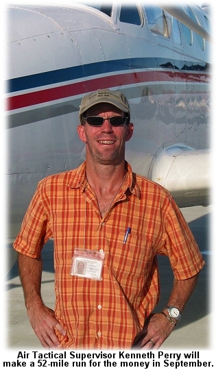 Pledges are being sought by the Foundation in support of Perry's "run for the money." Pledges are being sought by the Foundation in support of Perry's "run for the money."
An Air Tactical Supervisor for the BLM, Perry decided to make the run for the Foundation's 52 Club, the premise of which is to donate a buck a week to help injured firefighters or those killed in the line of duty and their families.
Perry's background includes smokejumping in Alaska and duty with the Fulton Hotshots on the Sequoia National Forest and the Kern County Fire Department. Five years ago he injured his back during a rescue operation in Alaska; even after a couple of surgeries he still deals with constant back and hip pain, but has found that long-distance running doesn't make his back any worse.
Perry and the Foundation are asking for pledges on a “per mile” basis in support of the 52-mile run. A referee will confirm the timing and distance; pledges will be sent directly to the Foundation.
Spectators and cheerleaders and followers are encouraged. "If anyone happens to be in the area on that day," says Perry, "please feel free to stop by; spectators make great motivators!"
To make a pledge in support of Perry's run for the money, check the SUPPORT page on the Foundation website, and note on the form that you're pledging in support of Kenneth Perry's run. Further updates and the run route will be posted on the Foundation's news page at wffoundation.org/news and more information is available from the Foundation at (208)336-2996.

COUNTY JEEP GETS PINK PAINT JOBJULY 25 -- LONGMONT, CO: A fire ignited by lightning on Friday was spotted and quickly smothered by airtankers, and bad luck timing on the part of a county employee resulted in a Jeep painting at the same time.
The fire at Heil Valley Ranch flared up at about noon Friday. Airtankers on their way to another fire spotted it and dropped on it, and county firefighters had it contained by mid-afternoon.
The Daily Times-Call reported that a P-3 Orion and a SEAT and a lead plane were flying over the area on their way to a fire near Red Feather Lakes when the lead pilot noticed the fire. The tankers dropped on the fire and "deluged" the Jeep of a county open space ranger arriving at the fire. They then headed off to reload and continue their assignment.
Boulder County Emergency Services coordinator Jay Stalnaker said the sheriff has told firefighters to take no chances. “The SEAT is going on standby every time, every call,” Stalnaker said.
A recent fire in the area temporarily closed public access to Heil Valley Ranch.
| 

 The anniversary day will honor the original flyboys of aerial firefighting in a tribute to 50 years of fighting fire from the air. In 1955, local pilots Floyd and Vance Nolta, of the Willows Flying Service, successfully modified a Stearman biplane to drop water on fires. Airtanker number 1 was in business.
 "It's only appropriate that the dangers these people fight on the ground and in the air be recognized," said Siskiyou County Supervisor Bill Hoy. He said the arrival of T-94 was "a great moment," according to the Mt. Shasta News, and he thanked veteran CDF pilots Cotton Mason and Bob Valette for flying the airtanker into retirement at her new home in Weed.
 Pledges are being sought by the Foundation in support of Perry's "run for the money."


 Pledges are being sought by the Foundation in support of Perry's "run for the money."


 Pledges are being sought by the Foundation in support of Perry's "run for the money."


 Pledges are being sought by the Foundation in support of Perry's "run for the money."

 According to

 The
The 
 The Rinehart Road Fire threatened ranches and homes. The Imbler Rural Fire Protection District called for assistance from the Oregon Department of Forestry, and crews from Elgin, Cove, La Grande, and Union also responded. Aerial resources included three airtankers and three helicopters, and the
  The fire's about 50 miles north of Grand Marais on the north side of Seagull Lake.